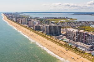
OCEAN CITY — It didn’t take long for federal elected officials to join the resort’s battle over an apparent error in flood zone mapping that has left some oceanfront property owners facing huge insurance premiums, as U.S. Senators Barbara Mikulski and Ben Cardin sent a strongly-worded letter to the agency’s director urging him to right the wrong.
Two weeks ago, Ocean City officials learned the details of a mistake in the Federal Emergency Management Agency (FEMA) flood zone maps for a vast section of oceanfront along condo row in north Ocean City that has left some property owners and condo associations facing hundreds of thousands of dollars in increases in flood insurance premiums. Last week, State Senator Jim Mathias entered the fray and urged his colleagues in the U.S. Senate to intercede on the resort’s behalf. This week, Mikulski and Cardin fired off a letter to FEMA Director Craig Fugate.
“We urge you to give the strongest consideration to the concerns raised by Mayor Meehan with respect to the area between 93rd Street and 123rd Street,” Mikulski said this week. “This section was mapped incorrectly and does not follow the line established by the Corps. As a result, these property owners now unfairly face exorbitant high flood insurance costs.”
FEMA has thus far refused to acknowledge the apparent mistake in the flood zone maps and has not backed down from the imposition of the staggering flood insurance premium rates. City Engineer Terry McGean said his office has been in constant communication with FEMA but the agency will not unilaterally change the maps, nor will they give an official endorsement of the city’s belief that the buildings are well outside the VE zone based on the location of the dune created by the Army Corps.
The only remedy FEMA will consider is for the city to officially apply for a Letter of Map Revision (LOMR), but that comes with a price. Collecting the data and conducting the appropriate modeling exceeds the capabilities of the city, requiring a consultant be hired. The consultant is requesting a $15,000 retainer to conduct the work with a total cost of $65,000, which would be paid only if the application was successful in getting the flood maps changed.
Mikulski said this week FEMA, and not Ocean City, should affect the appropriate changes.
“We understand that FEMA staff has already directed Ocean City to pursue a Letter of Map Revision,” she said. “Fixing this mistake should not be the town’s burden. We urge FEMA to fix this and immediately apply the already-established boundaries being used by the Corps in determining the VE zone boundary.”
Last July, FEMA issued new flood insurance rate maps for the Town of Ocean City that recognized the value of the dune system constructed by the Army Corps of Engineers as part of the ongoing beach replenishment project by locating the VE Flood Zone, or the most onerous flood insurance rate designation, “seaward of the landward toe of the primary frontal dune system.” In layman’s terms, FEMA concluded the eastern edge of the long-established dune line should be the line of demarcation of sorts for the higher flood insurance rates and any properties west of the primary dune would fall into a lesser flood zone designation.
However, in a few areas of the resort, particularly along condo row from 93rd Street to 123rd Street, FEMA has determined through its new maps an existing secondary dune, built in front of several oceanfront properties in the early 1980s is now the standard by which the VE Flood Zone is determined. As early as 1983, the town mandated certain new oceanfront projects construct a dune in front of the properties to protect them somewhat from storms, coastal flooding and beach erosion.
Years later, the primary dune was constructed through the beach replenishment project. As a result, the primary dune is out in front of the older secondary dune with a fenced alleyway of sorts about 10 feet wide in most cases separating the two. However, FEMA’s newest maps in many cases along condo row are now designating the seaward side of the secondary dune as the line marking the VE Flood Zone.
As a result, numerous oceanfront buildings now find themselves partially in the VE zone, some by as few as five feet. Because federal policy states if any portion of a building is located within the VE zone, the entire building is subject to the flood insurance requirements. For some individual property owners, the flood insurance rates in the VE zone run as high as $22,000 annually. For at least one oceanfront property used as an example, the flood insurance premium for the entire building approached half a million dollars.
For his part, Mathias this week thanked Mikulski and Cardin for quickly weighing in on the FEMA flood map issue.
“I am most appreciative of our effective and quick-responding U.S. Senators to request the FEMA map corrections for Ocean City,” he said.

