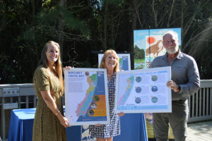
OCEAN CITY – A new map is expected to educate students, teachers and community members on Maryland’s coastal bays.
On Tuesday, a new classroom map designed by the Maryland Coastal Bays Program (MCBP) and the University of Maryland Center for Environmental Science was released to the public. Liz Wist, MCBP education coordinator, said the map will be distributed to classroom teachers, homeschool groups and community leaders in an effort to share information on the Maryland coastal bays watershed.
“What I think is the most important part is we are more accessible,” she said in a presentation Tuesday. “The word coastal bays is now going to be strewn around our county in different ways than we already have, and especially in every classroom.”
MCBP Executive Director Kevin Smith said the idea for a classroom map of the coastal bays watershed came about in two ways. He noted he had first received a call from Pat Schrawder, district representative for Sen. Mary Beth Carozza, seeking a map of the coastal bays. He said he was then approached by Wist with an idea for a classroom map.
“We really didn’t have a good map for folks and classrooms,” he said. “Liz carried this forward and got these maps made.”
For her part, Wist said her own classroom experiences growing up had inspired the idea for a classroom map.
“Sometimes my eyes would divert from the presentation, and I’d read everything around the classroom …,” she said. “I’d read everything, absorb it all and remember all the images as I was seeing it.”
With that in mind, Wist, MCBP staff and the University of Maryland Center for Environmental Science began working on a coastal bays map that would educate and inspire others.
“We’re very privileged under this administration to have infrastructure funding,” she said. “So we set aside some money for printing and for contracting with the University of Maryland Center for Environmental Science.”
The result, she said, was a double-sided map, with information about the coastal bays on the front and visuals of the watershed on the back.
“Anybody can come up, read a part of it and take what they want from it,” she said.
Officials say a few hundred maps have been printed and will be distributed to classrooms and community and homeschool groups in the coming months.
“I hope it familiarizes them with the watershed a little further and instills in them a deeper sense of place to where we live,” Wist said.
During Tuesday’s announcement, MCBP presented Carozza, Commissioner Eric Fiori and Worcester County Public School staff with their own copies of the coastal bays watershed map. Carozza said she is excited to use the map to educate her colleagues in and around the state.
“When I talk about my district, I talk about the four F’s – farming, fishing, forestry and fun,” she said. “The Maryland coastal bays is right in the middle of all of that. So this map will be proudly on display in my Annapolis office to continue with education.”
Fiori said he believed the new map offers school children a visual representation of Maryland’s coastal bays. He noted that visuals and hands-on experiences were what shaped his childhood education.
“Yes, I learned timetables in fourth grade and all that other stuff, but the lasting memory for me was the touch and feel of nature,” he said. “And that’s why today, at 40-plus years old, no hair, this is why this stuff is still so important to me. “
Jen Sills, coordinator of instruction, K-12 science, environmental education and school library programs for Worcester County Public Schools, applauded the new coastal bays maps.
“It’s amazing to have visuals …,” she said. “I’m thrilled to have a program like this available to kids.”

