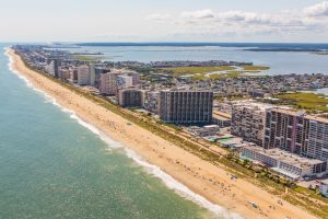
OCEAN CITY — Just one week after Ocean City officials learned an apparent error in federal flood zone mapping has left some oceanfront property owners facing hundreds of thousands of dollars in flood insurance premiums, State Senator Jim Mathias (D-38) has reached out to the state’s congressional leaders to intercede on the resort’s behalf.
Last July, the Federal Emergency Management Agency (FEMA) issued new flood insurance rate maps for the Town of Ocean City that recognized the value of the dune system constructed by the Army Corps of Engineers as part of the ongoing beach replenishment project by locating the VE Flood Zone, or the most onerous flood insurance rate designation, “seaward of the landward toe of the primary frontal dune system.” In simpler terms, FEMA concluded the eastern edge of the long-established dune line should be the line of demarcation of sorts for the higher flood insurance rates and any properties west of the primary dune would fall into a lesser flood zone designation.
However, in a few areas of the resort, particularly along condo row from 93rd to 123rd streets, FEMA has determined through its new maps an existing secondary dune, built in front of several oceanfront properties in the early 1980s is now the standard by which the VE Flood Zone is determined. As early as 1983, the town mandated certain new oceanfront projects construct a dune in front of the properties to protect them somewhat from storms, coastal flooding and beach erosion.
Years later, the primary dune was constructed through the beach replenishment project. As a result, the primary dune is out in front of older secondary dune with a fenced alleyway of sorts about 10 feet wide in most cases separating the two. However, FEMA’s newest maps in many cases along condo row are now designating the seaward side of the secondary dune as the line marking the VE Flood Zone.
As a result, numerous oceanfront buildings now find themselves partially in the VE zone, some by as few as five feet. Because federal policy states if any portion of a building is located within the VE zone, the entire building is subject to the flood insurance requirements. For some individual property owners, the flood insurance rates in the VE zone run as high as $22,000 annually. For at least one oceanfront property used as an example, the flood insurance premium for the entire building approached half a million dollars.
Last week, the Ocean City Mayor and Council learned the extent to which many oceanfront properties, particularly along high-rise condo row, are affected by the apparent error in the FEMA flood zone maps. As a result, city officials immediately fired off a letter to its representatives in the U.S. Senate and House asking them to intercede with FEMA on the town’s behalf.
This week, Mathias joined the fray, reaching out personally to Senator Barbara Mikulski (D-Md.) with a hand-delivered letter requesting her immediate action. Mathias has also written to Senator Ben Cardin (D-Md.) and Congressman Andy Harris (R-Md.) seeking their intercession on the town’s behalf.
“For many years, we’ve worked effectively with our state and federal partners to protect Ocean City and its citizens from storms and flooding through our beach replenishment program,” he said. “Unfortunately, this FEMA error vacates so much of our good work.”
FEMA’s most recent interpretation of flood zones deems certain properties, particularly on the north end of Ocean City, to be dangerously flood-prone. The result of the misinterpretation is some property owners are being saddled with skyrocketing flood insurance premiums.
FEMA’s misinterpretation looks to a previously existing dune system as the resort’s primary dune protection. Ironically, the new maps deem properties located further inland from the dunes created during beach replenishment as being even more vulnerable to flooding when, in fact, most properties affected have a double layer of dune protection. Last week, City Engineer Terry McGean pointed out the anomaly to resort officials.
“Essentially, this is penalizing a property for having more dune in front of it,” he said. “There’s really no other way to put it.”
Nonetheless, FEMA thus far has not acknowledged the apparent mistake and has not backed down from the imposition of staggering flood insurance premium rates. Mathias said this week the result is higher flood insurance premiums totaling millions of dollars cumulatively for all of the properties affected. For that reason, Mathias has joined resort officials in reaching out to its federal delegation in getting the map errors amended and the insurance premiums lowered for the affected properties.
“I look forward to working with them for a successful solution to this urgent matter so that we’re able to provide the correct and appropriately priced insurance premiums for the protection of our oceanfront community and property owners,” he said.

